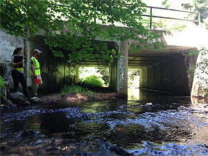
 Throughout the summer and continuing this fall, volunteers have been working within the Farmington River Watershed to inventory river and stream crossings and the impact they have on local wildlife.
The River and Stream Continuity project aims to identify stream crossings that prevent the travel of aquatic and terrestrial organisms. There is growing concern that road crossings — and especially culverts — have negatively impacted habitats of aquatic organisms, and disrupted their ability to traverse areas of rivers and streams vital to their survival.
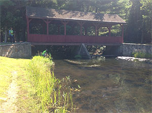 Many culvers are designed with the principal objective of redirecting water under a road but fail to meet the needs of aquatic and terrestrial wildlife. Fish for example, may travel up and down a river many times in the process of feeding and reproducing. A culvert that sits above the stream bed will prevent this essential travel, and can often greatly reduce aquatic connectivity while reducing the biodiversity of a stream or river.
By locating these stream crossings and documenting their type and dimensions, the ones that have the largest impact on aquatic connectivity can be identified and potentially remodeled or replaced.
 The North Atlantic Connectivity Collaborative (NAACC) launched the Stream Continuity Project in 1998 in Massachusetts and has since spread across thirteen states in the North East. For further information or to view the data on a crossing near you, visit <a href=”http://StreamContinuity.org”>StreamContinuity.org</a> and select the “database” tab.
